Historic County Map - Lagrange County Indiana - Andreas 1876 - 23 x 28.5 - Vintage Wall Art
Product information for Historic County Map - Lagrange County Indiana - Andreas 1876 - 23 x 28.5 - Vintage Wall Art
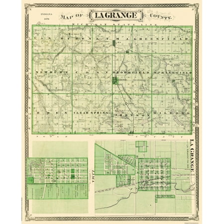
Old County Map - Lagrange Indiana - 1876 - This is an exquisite full-color Reproduction printed on high-quality gloss paper art paper or canvas. Print Size: 23.00 x 28.50 inches 58.42 X 72.39cm Sites and Townships Specific To This Map Are: Original Townships at this time of: Van Buren Lima Greenfield Newbury Clay Broomfield Springfield Eden Clear Spring Johnson Milford Town Plan of Lima Town Plan of Lagrange Hobb s Marsh State Ditch Twin Lakes Hood s Lake Lake of the Wood s Elkhart River Brushy Prairie Post Office Mongo Post Office Haw Patch Post Ofice Churches Schools and Many Other Prominent Buildings. The following towns are featured: Van Buren Lexington Ontario Lima Lagrange Springfield Nauvoo Wolcottville & Walnut Corner. This Map is Situated in: Lagrange County Indiana. SKU: INLA0002 Original Maps are often difficult to find and usually have fold lines identifying stamps or markings tears ragged edges and assorted other natural signs of age that detract from their beauty. All of our maps have been professionally restored to depict their original beauty while keeping all historical data intact. These maps are fabulous pieces of history full of information useful to Historians Genealogists Cartographers Relic Hunters & Others. They make fascinating conversation pieces and splendid works of art for the home or office.


